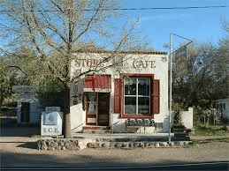
Easy to miss…

Twice in the past month, I’ve driven along New Mexico highway 61 between Deming and San Lorenzo on the way to Lake Roberts. It’s a seldom traveled route worthy of a detour if you’ve ever looking for a slightly longer and more scenic drive to Silver City from Las Cruces.

The road wanders along the Mimbres River valley, passing through a rapidly changing southwestern landscape with fascinating rock structures, groves of cottonwoods, hills dotted with pinon and juniper, and eventually leading to ponderosa pine forests as you approach Lake Roberts.

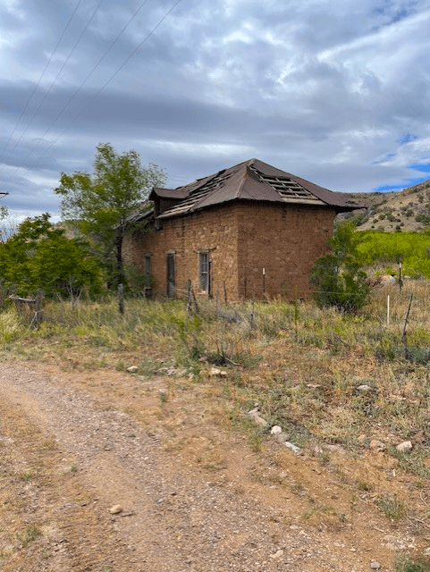
On my last two trips, I stopped to photograph an old homestead in the village of San Juan that in my mind was once probably one of the finest residences in the Mimbres Valley. I am sure most people driving along New Mexico 61 just zip by the house and don’t register it as anything more than just a ramshackle adobe home from a past era.

It caught my eye because I think it exhibits what is classic northern New Mexico territorial style architecture.

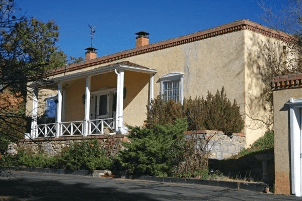
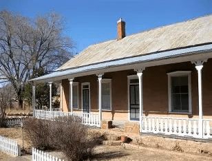
If you search “New Mexico territorial style architecture,” structures fitting that description usually include the following elements: The walls are traditional adobe, but with white-trimmed Greek Revival arches over the windows and doors, formal porches with square (instead of rounded) posts and rows of red bricks along the top of the walls. Homes of this genre in the most northern reaches of New Mexico often had pitched corrugated tin roofs to shed more frequent snow and heavier rains. The bricks along the tops of the walls on flat-roofed homes were added to help stabilize the adobe walls and keep them from melting away in the region’s monsoon rains.

New Mexico territorial style home with brick on top of adobe walls
Northern New Mexico territorial style with pitched tin roof

The “New Mexico Territorial” design was introduced New Mexico beginning in the 1800s by Americans who lamented the lack of architectural detail they had come to expect in homes and other buildings in the eastern United States. As one early American general observed, cities in northern New Mexico were nothing but a collection of “a few mud huts.” A U.S. Dragoon, William Bennett, described the town of Las Vegas as “a great pile of unbaked brick” adding, “Upon closer inspection everything about the town was dirty and filthy… [with] miserable dirty streets [that] all look alike.” And, as U.S. soldier Frank Edwards described his first visit to the village of Mora:  “nothing could be more discouraging to me… than the first view of this town.”

The wooden trim for the windows, doors and porches was not immediately available in New Mexico in the time period when American first began arriving in the early 1800s. Gen. Stephen Watts Kearny, who was assigned to New Mexico in 1846 to lead American troops in the Mexican-American war, apparently agreed with the dearth of architectural detail in the region. A search about New Mexico Territorial style said the general himself ordered machinery to establish a mill to cut wood to allow addition of Greek Revival elements to enhance the appearance of the “mud huts” so prevalent in the state.

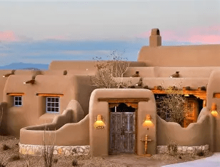
New Mexico Territorial style is different than the Pueblo Revival architecture that was introduced by famed New Mexico architect John Gaw Meem in the 1920s and 1930s. That style featured multi levels, more rounded walls and protruding round vigas similar to those features found in New Mexico’s historic pueblos.

Pueblo revival style home

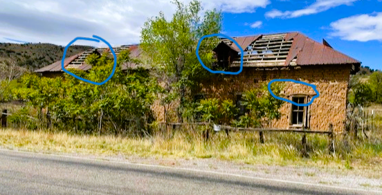
It was clear to me that the home along the Mimbres Valley in the village of San Juan was carefully designed and constructed by its proud owner. The windows all exhibited the Greek Revival arches and the tin roof included two dormers that would not have appeared on an ordinary “mud hut.” The yard was once fenced in and landscaped, from what I could observe. I was not able to see the west side of the home, where I suspect there was a porch and entrance that welcomed residents of the home and visitors.

Note dormers and window accents circled in blue
North side of the house. Note remnants of fence and dormer.

As I said earlier, I suspect it was one of the finest homes in this remote part of southwestern New Mexico. I wonder what stories this old home could tell about its occupants. So if you’re driving on New Mexico 61 some day in the future, stop in San Juan and take a look at the old homestead, then ponder what stories it might tell.

Testing the limits of adhesion…

Many years ago a friend and kindred spirit in the admiration of all things BMW had acquired a non-USA certified version of a 1977 BMW 320i. It was actually a 320 (the “i” which was missing from the model identification designated fuel injection, which this car did not have. Instead, it had a hot Weber carburetor setup.)

The car also did not have many emission controls, safety barriers in doors and other weight inducing safety and compliance additions, which made it very lightweight, very fast and nimble on curves.

My friend announced that he was going to “test the limits of adhesion” with that car on the twisty and challenging Emory Pass road on New Mexico highway 152 between Hillsborough and San Lorenzo through the southern tip of the Black Range.

My friend and the car (which was imported illegally from South America to Austin, TX,) survived what I’m sure was a thrilling and harrowing drive along the route, complete with multiple hairpin turns, switchbacks, blind corners and occasional wildlife suddenly wandering across the road.

(Ironically, I ended up owning that car which my daughter drove all through high school and college. It served us well until the engine threw a rod going over “The Grapevine” or Tejon Pass on Interstate 5 north of Los Angeles on a return trip to Las Cruces right after she graduated from college. But that’s another story for another time.)

Anyway, my post today is not about cars but about that section of road in southwestern New Mexico which is worth a drive.

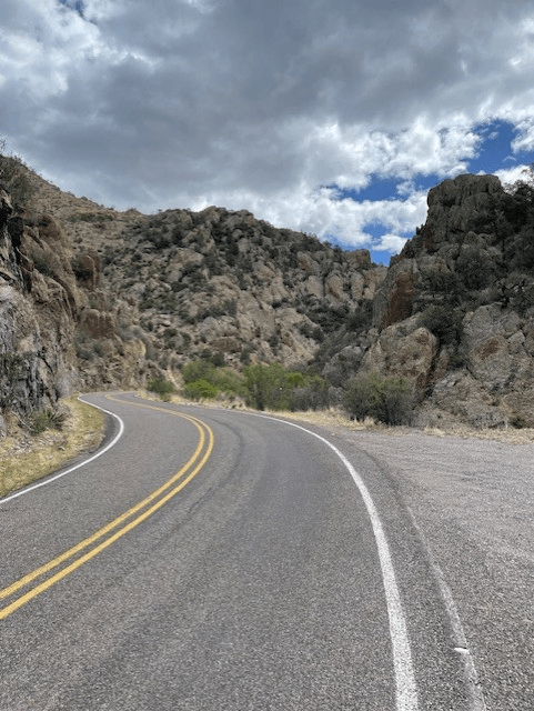
I had not been on the road since my children were very young. My wife and I (and faithful dog Chester) decided to take a trip along NM 152 this weekend, traveling slowly in our pickup truck to appreciate all the sights rather than zipping along the highway in a BMW to “test the limits of adhesion.” We discovered that many of the forests along the route had been scorched by multiple wildfires, but there are still many stands of trees still there and other vegetation is making a strong comeback.

Section of NM 152 twisting through a rock canyon.

Emory Pass tops out at almost 8,200 feet, with pine, fir and spruce trees covering the steep canyons where past fires have not burned. Spectacular rock formations appear all along the route and there is a great view from the top of the pass to the east to the Rio Grande Valley and the west to more Gila wilderness.

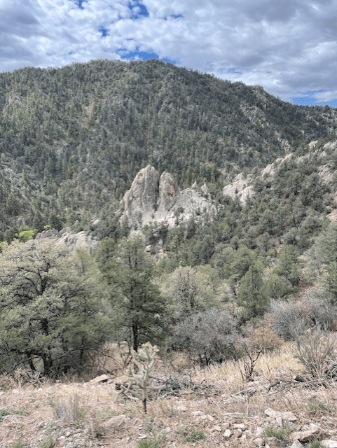
A rock formation along the route near Iron Creek

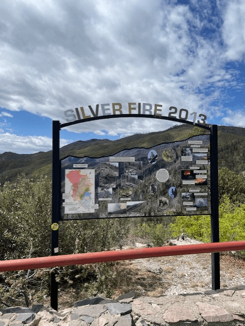
As I mentioned, multiple wildfires have wiped out sections of forest in recent years, the worst of which was the 2013 “Silver Fire” which affected much of the southern tip of the Black Range.

The hillside appearing beneath the arch was once covered in pine, spruce and fir trees. You can still see a few snags along the top of the ridge.

Whether you choose to zip through the Black Range in a fast car or chose a more leisurely drive in a lumbering pickup, the drive along New Mexico 152 is well worth it. Our drive took a little over four hours. You can picnic at several campsite along the route, or stop for lunch at the Hillsboro General Store Cafe (one of our long-time favorites), either way the drive is worth the time.

Hillsboro General Store Cafe

What’s next? Lawrence of Arabia filmed in Alaska???

A front page article in our Las Cruces Sun-News this week told about the filming of three movies in and around our desert community about — wait for it — SHARKS!!! Two of the movies by the film company called The Asylum are entitled “Shark Shiver” and “Shark Frenzy” and the third apparently has not been named. The films will be released this summer.

And I thought the movie “Sharknado” was a stretch.

But wait, it gets better. The Asylum film studio was actually the one that produced the original Sharknado movie and has produced five sequels. And production is in the works for the 7th in the series which may or may not be filmed here in Las Cruces. And at least for one of the films, there was actually water involved with scenes filmed at Elephant Butte reservoir.

This is a quote from the article about the shark movie production plan from producer David Latt:

“… You ask yourself, how can you make any shark film in the middle of the desert?” he said. “It’s amazing what we can do

in post certainly, but as long as the actors are there and you have the essentials, you can really make anything work, and I think, at the end of the day, I think the audience will be captured … “

What’s frightening about his comment is how any video or photo can be manipulated so easily and how we have to be careful about what we see and think as being real.

It also speaks to the quality of these three films in that they were shot in a matter of three months. My wife and I recently watched the movie “Ben Hur” and were fascinated by the huge production effort to make that epic film. Planning for the film began in 1952 and it was not released until 1959. More than 10,000 extras were used in the film and the budget (1959 dollars) was more than $16 million. (More than $180 million in today’s dollars). I don’t know how big the budget was for the three locally produced shark movies, but the producer said they had used five local extras.

But I think the producers need to come back and produce a truly blockbuster movie featuring a shark that roamed the shallow seas covering much of New Mexico 30 million years ago. The creature was appropriately named “Godzilla Shark.” I mean, how much better movie title could you have.

Rendition of ancient Dragon or Godzilla shark, Dracopristis Hoffmanorum

And the plot goes like this:

A low-budget film crew is filming a shark movie at Elephant Butte when out of an underwater cave comes the pre-historic shark monster that has been reawakened from its fossilized remains. The shark fossil, in a layer of ancient seabed rock, was energized by radioactivity from the Manhattan Project’s first atomic bomb test just northeast of the lake. It comes out of the water onto the shores of Elephant Butte, walking with leg-like fins created by a genetic mutation, also from radiation exposure. It immediately eats the camera crew, then crawls eastward to Spaceport America, where — with its radioactively induced intelligence — manages to get aboard Sir Richard Branson’s low-orbit spacecraft. It launches itself and flies over the Gulf of Mexico where it suddenly gives birth to hundreds of babies. The spacecraft crashes into the water and all aboard survive. Suddenly the world is threatened by these intelligent voracious monsters with no less than 12 rows of teeth and an appetite for humans.

Okay, I’d better stop here because I’m expecting a phone call any moment from The Asylum studios to buy my script. Watch for me next year on the next Academy Awards for the best screenplay award.

3D printing invented in the Gila…

As I have written in previous posts, I’m always fascinated by the Gila country of southwestern New Mexico. I’m always finding something new in the landscape or in the culture of its human past.

On my most recent trip to help school children from Silver City release once endangered Gila trout into Lake Roberts, I drove by a certain rock formation that I had seen before. Looking at it with renewed interested, it dawned on me that it looks suspiciously like something I’ve seen elsewhere.

I’m sure all of you are marveling at the capabilities of 3D printing. A good friend of ours has recently developed a device he can make from various types of plastics to help humans overcome shoulder problems. Who knows how many other applications are being developed to help humans deal with health issues. Two of our own grandchildren have their own small 3D printer which they have used to make such things as copies of Lego bricks.

And I’ve seen recent videos of how a 3D “printing” process can form walls from concrete for residential and commercial structures. I captured this photo on the Internet showing a device shaping walls with ribbed layers of concrete on a construction project.


3D concrete printing. See if you see any resemblance with the rock formation below

So when I looked at the rock formation below along the highway between Lake Roberts and San Lorenzo, you can see why it caught my attention.

Rock face along New Mexico highway 35 between San Lorenzo and Lake Roberts

Look closely at the picture above and you can see the multiple horizontal layers of rock that are almost symmetrical in depth. It’s almost like a giant 3D printing device formed this rock structure in prehistoric ages.

I looked up the geology of the Gila country and most of it was formed about 30 million years ago. There are various phases of its development, including intense volcanic activity, continental movement and the presence of shallow seas. The New Mexico Geological Society has produced a guidebook about the geology of that region which you can purchase at this website https://nmgs.nmt.edu/publications/guidebooks/59/. Much of it is much more technical than I understand and you can find more about the region’s geology on the Internet.

My uneducated suspicion is that this layered rock was built up over eons underneath a shallow sea which once covered much of the Southwest or was layered by some volcanic ash/lava flows. I’m going to try to do a little more research and will let you know what I discover.

In the meantime, on your rush to Lake Roberts or anywhere in the Gila, take some time to look at all the interesting geological features which make this region of our state so special.

Tunnel vision…

I wrote recently about the fact that New Mexico does not have any toll roads, although a “smishing” effort that reached a lot of people in our state claimed that we have one. I got a letter or an e-mail from the scammers suggesting I had not paid a New Mexico toll road fee recently and that I was in big trouble if I did promptly provide my credit card number and other personal information. I declined.

(However, if you read that blog, you’ll learn that one New Mexico’s northern Pueblos made a short-lived attempt to impose a toll fee for motorists passing through its lands in the late 1970s. Here’s the link https://aero-cordero.com/2026/03/31/we-kind-of-had-one/)

And as far as our state highways go, we also are on the short end of the number of tunnels in our state.

As best as I can count, there are three in our state, but only one of which is kept open all year long and used daily.

In the Jemez Mountains north of Albuquerque, there are two tunnels on a state road that is open on a seasonal basis. Those are the Gilman tunnels, carved out of solid rock to originally serve a railroad route into the mountains to transport timber. The two short tunnels were constructed in the early 1900s by the long-defunct Santa Fe Northwestern Railway and named after a railroad executive, William H. Gillman.

Inside one of the Gilman tunnels, with the opening for the second in the background. Both are on New Mexico 285.

They are both located on New Mexico 285 along the Guadalupe River. You can tell by the high and narrow architecture that they were originally intended for locomotives and rail cars. The state highway connects to an unpaved U.S. Forest Service road a short distance from the two tunnels.

At least two movies have featured the tunnels, “3:10 to Yuma” filmed in 2007 and “The Lone Ranger” made in 2017.

The Santa Fe Northern Railway folded in 1941 after suffering financial difficulties during the Great Depression and experiencing severe damage to its route during flooding in the narrow canyon in the Jemez Mountains in the late 1930s.

The best-known highway tunnel in the state is along U.S. 84 between Alamogordo and Cloudcroft. Opened in 1947, the 528-foot-long tunnels has become a staple of the dramatic drive between the Tularosa Basin desert surrounding Alamogordo and the cool mountains of Cloudcroft at almost 9,000 feet above sea level.

Eastern entrance to the Cloudcroft tunnel on U.S. 82.

As a newcomer to New Mexico in the 1950s, I vividly remember our family’s first drive through the tunnel, with windows open and our father constantly honking the horn on our pea-soup green Plymouth sedan as we negotiated the short passageway through solid rock. I still shamelessly honk my horn with my children and grandchildren in the car when we drive through it. (I think I even do it when no one else is with me in the car.)

Before 1932, a trip from Alamogordo or Las Cruces to Artesia required drivers to navigate a steep and winding unpaved road up the west side of the Sacramento Mountains, then through the forests on top of the mountains and then along the Rio Penasco to the east.

In 1939, a group of businessmen from Alamogordo, Tularosa and Cloudcroft met with state officials in Santa Fe to propose a faster route. State officials agreed to fund the project, although construction did not begin until eight years later.

 At $2 million, it was said to be one of the most expensive sections of highway ever built in New Mexico at the time. The state specified that no section of the road could have more than a 6 percent grade. Two long truck escape ramps were included as part of the construction, along with the famous tunnel. Some Native American artifacts in a cave on top of the tunnel had to be removed as part of the construction.

Amazingly, it was completed in just two years, with the grand opening on Nov. 20, 1949, in a ceremony attended by a crowd estimated at 1,000 people.

Over the years, the tunnel has been reinforced and is still occasionally closed to remove falling debris as the canyon sheds its rock and plant formations.

And it’s still a great place to get in your childhood “honks.”

Back home again…

For the third time in four years, I’ve participated in the release of trout raised in the classrooms of elementary schools under Trout Unlimited’s Trout in the Classroom program.

The program is designed to encourage students to appreciate the environment, the value of clean cold-water fisheries, to take responsibility for raising and caring for a living creature that will be returned to the wild and to encourage them to learn about fishing.

This latest release, however, was very special to me. It involved the release of once endangered Gila trout back into their home waters in the Gila Wilderness of southwestern New Mexico.

I’ve been writing about Gila Trout for about 50 years, from when they were first placed on the endangered list, to when they were downlisted to threatened, then back to endangered when terrible forest fires ravaged their native waters in the Gila Wildness.

The species has been moved back to threatened status but with a special exemption under the Endangered Species Act that allows the fish to be caught. Through determined conservation efforts, self perpetuating populations of Gila trout have now been established in certain waters in southwestern New Mexico and eastern Arizona so that anglers can now catch and keep them.

Gila trout (Oncorhynchus gilae), one of the rarest trout species in the United States.

In northern New Mexico, the Rio Grande cutthroat trout was on the verge of being listed as endangered, but a long-term effort has made that species’ outlook strong enough to allow it to escape that classification. The Gila trout, however, was truly on the edge of extinction.

The fact that this species has now been made available for the Trout in the Classroom program was a culmination of many years of dedicated work. It included initial optimism, followed by periods of great anguish, then finally buoyed by the realization that they could once again swim throughout their original habitat in one of the most inhospitable landscapes where cold-water species of fish can be found in the United States.

Illustration of Gila trout head by artist Michelle Arterburn

The Trout in the Classroom project at G.W. Stout Elementary School started more than a year ago under the direction of a dedicated teacher, Keith Rogers, who is an avid outdoorsman and has a passion for the open spaces of southwestern New Mexico and the Gila Wilderness. Trout eggs were delivered to the school last spring from the U.S. Fish and Wildlife Service in Mora, NM. Rogers’ students monitored water quality, fed the fish, cleaned the aquarium, recorded their progress and wrote about the project.

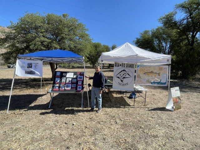
As the coordinator for Trout in the Classroom projects for Trout Unlimited’s Gila-Rio Grande Chapter, I’m proud to say I had a role in helping obtain equipment, direction and support for the program.

With about 50 students from the school present last week on April 2, we released 14 of the fish into Lake Roberts, a man-made lake fed by the waters of Sapello Creek, which from there flows west into the Gila River. There was great support from students at G.W. Stout Elementary, involved parents, other teachers at the school, the U.S. Forest Service, New Mexico Game and Fish, Trout Unlimited, Silver City Consolidated Schools, the U.S. Fish and Wildlife Service, student groups from New Mexico State University and Western New Mexico University and the Mesilla Valley Fly Fishers (of which I am also a member). With all the turmoil in our country today, it’s a great feeling that so many groups and individuals can get together to make a project like this happen and be so successful.

With assistance from Eileen Henry (holding net) of the U.S. Forest Service, student Emmanuel Castenon from G.W. Stout Elementary releases a four-inch Gila trout into Lake Roberts.

Below is a video of some of the fish in a special cooled and aeriated containersjust before they were released into Lake Roberts. Notice how colorful the juvenile fish are:

Gila trout raised in a classroom in Silver City, ready for release in home waters in the Gila National Forest. Video by Eileen Henry, U.S. Forest Service

The students seemed to be happy to participate in the field trip. They acted — well like my own 11-year-old granddaughter and 12-year-old grandson act — full of energy, occasional moments when they were focused on the project and lots of social interaction.

In addition to releasing the fish, there were activities for the students. One was a eco-scavenger hunt, where students had to collect things like pine cones, juniper berries, aquatic insects, oak leaves, etc. A bonus for a prize was if they brought in trash from around the area where the fish were released. There was also a nature hike and a fly casting clinic, which I helped with as much as I could with windy conditions and “tween”
attention span limits that are normal for that age.

G.W. Stout Elementary student Jeremiah Rotert with his collection of trash from the eco-scavenger hunt.

Finally, below is a picture of the group, not including about a dozen other volunteers. It was a great day at Lake Roberts, for the students, for the adults and for the fish that are now swimming freely in their new waters.

Students, teachers and volunteers at Lake Roberts before release of the Gila trout

Hold on there, Tex…

Two recent stories about Texas wanting to grab some of New Mexico’s southeastern counties prompted me to look at some historical facts about our state’s boundaries over the years. And in particular, I wanted to look up Texas’ oft-repeated claim that The Lone Star State once included much of New Mexico.

Texas in fact wanted to “claim” a large chunk of New Mexico east of the Rio Grande, the watershed for that river into Colorado and beyond, and for some unknown reason, a thin strip of land all the way up into Wyoming at the 42nd parallel.

They key word here is “claim.” As far as I could research, there was never an official document granting Texas those lands when it joined the United States. Texas apparently argued that it got the right to those lands through a sketchy treaty signed under duress by Mexican General Antonio Lopez de Santa Ana of Alamo fame after his stinging defeat at San Jacinto. There has been much written about New Mexico’s borders and the West’s shifting state lines and I’m sure many Texans will continue to stand by their bogus claim.

The Texas story is as if I could just suddenly “claim” to own the New Mexico State University pecan orchard just down the street from our home without any legal authority to back me up.

The Texas “claim” that was never official.

What is interesting is that when Texas “claimed” much of New Mexico and Colorado, it basically wanted all the water rights to the Rio Grande and the Pecos River. The most recent attempt by Texas to poach New Mexico’s lands appears to be the desire to fold our rich Permian Basin oil fields into that state’s ownership and control. After Texas, New Mexico is the second largest oil producer in the continental United States. Texas would apparently like to strip New Mexico of that resource.

The latest salvo in the Texas Land Grab came recently when the speaker of the Texas House, Rep. Dustin Burrow of Lubbock, proposed legislation to study feasibility of adding certain southeastern New Mexico Counties to the Lone Star State. He apparently made the “Texas once owned much of New Mexico” claim in an attempt to justify his proposal. The counties being sought are Lea, Eddy and Roosevelt, all rich in oil and maybe nearby Curry County, also part of the area long known in New Mexico as “Little Texas.” The action by Texas follows a recent failed attempt by a New Mexico State Representative, Randall Pettigrew of Lea County, to allow those counties to transfer to Texas.

Pettigrew says he introduced his proposal mainly to generate conversation about how he thinks the southeastern corner of the state is often neglected while providing much of the state’s revenue from oil and gas production in the Permian Basin. For those of residents living far away from the power centers of Albuquerque and Santa Fe, we’re all too familiar with being neglected by the folks north of Interstate 40.

To continue along this train of thought, I’ve seen the map below of how the United States at one time considered establishing the boundaries of New Mexico.

From the “Historical Atlas of New Mexico” by Warren A. Beck and Ynez D. Haase, 1968

Had that division stuck, Texas likely would have lost its claim as the biggest state in the continental United States, since the propsed territory included all of New Mexico, all of Arizona and sizeable chunks of Colorado and Nevada. It would have been a truly spectacular single piece of real estate, including the Grand Canyon, some of the Rockies’ tallest peaks, the Mogollon Rim, the Sonoran Desert and yes, that other Las Vegas and Lake Mead.

So if Texas continues to “claim” most of New Mexico was once part of that state, we can just as easily claim that New Mexico was once bigger than Texas. Take that Lone Star State!

We kind of had one…

Many New Mexico residents, including me, have been receiving scam mailings or e-mails regarding pending punitive action because we have not paid for recently traveling on a state toll road.

SPOILER ALERT: There are no toll roads in New Mexico.

The mail I got wanting me to pony up my credit card number and other personal information was pretty sketchy. It was sent from an out-of-state address, did not specify what toll road was involved, did not identify my vehicle and except for a fuzzy rendition of the state seal, did not have any appearance of an official state legal document. And my fine for not paying the toll was due Feb. 4 — oops, I missed that deadline. “:^{

On various recent social media postings I’ve read, people have been laughing about how lame this so-called “smishing” expedition is. Below is a link to the New Mexico Department of transportation warning state residents about the scam:

But hold on a minute — there was actually an attempt to establish a toll road along New Mexico 285-84 in northern New Mexico about 1978.

U.S. 285 in northern New Mexico

It seems that the Nambe Pueblo, between Santa Fe, Espanola and Los Alamos, felt the state owed the Native American pueblo money for allowing U.S. 285 and U.S. 84 to cross their lands. The conflict revolved around tribal sovereignty and the pueblo’s claim that the state had not lived up to its requirement to compensate it for the right away across their sacred lands.

I was a journalist with United Press International at the time and remember seeing photos and hearing stories of people being stopped at tribal roadblocks on the highway as it passed through Nambe Pueblo lands, with officers demanding toll money from motorists. The route is heavily traveled, with employees at the Los Alamos National Laboratory, and workers from Espanola who had jobs with the State of New Mexico flooding the route at rush hour. I don’t recall the temporary toll road lasting for very long before the state realized it needed to renegotiate the right of way agreement with Nambe and other northern Pueblos along that route.

Negotiations over the right of way continued for years and things mostly calmed down until in 1995, when a federal prosecutor threatened to shut down gambling casinos operated by the various pueblos along that heavily traveled stretch of highway.

Pojoaque Tribal Leader Jacob Viarrial was adamant in his intention to close the highway because of the threatened shutdown of the casinos.

“It’s to show our frustration,” Viarrial said of the road blockade on Christmas day in 1995. “It’s to show that we have come to the end of the line. We’re backed into a corner. We’ve become a wounded animal and we need to fight back.”

Working with then Gov. Gary Johnson, the state was eventually able to negotiate a deal between the tribes and the federal government which allowed the casinos to remain open.

Why I love New Mexico…

For years, mostly when my son and daughter were younger and still in college, I’d send them random e-mails about funny things I’ve sighted in my travels through the state or had read about in local newspapers.

Things like a State Police officer having his way with a woman on the hood of his cruiser while a pet Chihuahua looked on and the security camera was rolling. Things like a ghost wandering through an Espanola public services parking lot. Things like the sign on the Navajo Nation offering to sell live goats and Avon products at a roadside stand.

These e-mails were incubators of my current Aero-Cordero blog, which reports on topics historical, hysterical and just plain weird about our 49th state. My son once said that Espanola’s slogan should be “Espanola never disappoints.” I think that could be expanded to say “New Mexico never Disappoints.”

A couple of things showed up on my radar last week that fall directly into the “never disappoints” category.

First, did you know that the only time in current history* that the United States mainland has been invaded by an organized para-military force was right here in New Mexico — just about 60 miles west of us in the town of Columbus on the U.S.-Mexico Border 110 years ago.

Mexican troops led by Pancho Villa invading the town of Columbus, NM, on March 9, 1916, 110 years ago.

Villa, a self-appointed defender of the agrarian poor in northern Mexico, organized the raid because he was angry at the United States for supporting the incumbent Mexican president, Porfirio Diaz, in a major escalation of the ongoing Mexican revolution.

Pancho Villa, with his requisite bandolier outfit

On March 9, 1916, Villa led roughly 500 of his supporters known as “Villistas” in a raid on Columbus, New Mexico, and the adjacent U.S. Army camp, killing 17 Americans (10 civilians, 8 soldiers). The attack, prompted President Woodrow Wilson to send a “Punitive Expedition,” led by Gen. John J. Pershing, into Mexico, though they failed to capture Villa after nine months of searching. It also marked the first time American aircraft were used in a tactical mission in another country.

Approximately 70 Villistas were killed during the raid, including some who were captured and later hung.

As an aside, I worked with a woman in one of my previous careers who had grown up in El Paso and said her grandmother had done Villa’s laundry when he was in the city just across the border in Juarez. By all accounts, Villa was very kind and paid her grandmother handsomely for her work.

Last week I wrote about the efforts of Robert Goddard, the pioneer of liquid fueled rockets who did much of his early research in the high plains of southeastern New Mexico near Roswell. His first experimental rocket was launched just a little over 100 years ago on his aunt Effie’s farm in Massachusetts.

Because of his efforts, Germany began further development of liquid fueled rockets which led to the formidable V2 rocket used toward the end of World War II on England. After the war, the United States captured several of these rockets and began deconstructing and testing them at our own White Sands Missile range just across the Organ Mountains from Las Cruces.

Captured German V2 rocket being tested at White Sands Mille Range.

On May 29, 1947, one of the V2 rockets being tested at White Sands went off course and flew south toward Juarez, Mexico, crash landing in a cemetery.

Confused residents of Juarez, Mexico, inspecting a large hole in a cemetery left by an errant V2 rocket launched from the United States military base of White Sands, NM.

The El Paso Times reported that between 1946 and 1950, about 60 captured V2 rockets were launched at White Sands for testing. The impact in Juarez on May 29, 1947, was a little too late to highlight a “Cinco de Mayo” celebration, but the El Paso Times said it did happen to “interrupt a nearby Mexican fiesta.”

So there you have it. We were invaded by another country in New Mexico and we conducted the first launch of a military rocket into a neighboring country from inside our own borders. That’s why I love New Mexico and its oddball history.

*To be clear, the War of 1812 involved multiple invasions by England into certain areas of the east coast of the United States. In those cases, the invasion was launched by sea. The Pancho Villa invasion was the first time a neighboring country crossed the border on land.

See ’em before they’re gone…

Saying that weather has been unusual this year has become a boring conversation starter these days. Everyone knows it. The only thing we don’t know is what’s going to get thrown at next us by mother nature.

One good outcome in our part of the desert Southwest this year was an unusually heavy four-day rain event in January that dropped almost two inches of precipitation. That was followed up by two fairly good soakers, leaving us with precipitation ahead of normal for this time of year.

That apparently helped trigger a desert super bloom of Mexican poppies along the edges of the Organ Mountains in our Chihuahuan desert.

Mexican poppies in Organ Mountain foothills last week

Mexican poppies are cousins of California poppies which also are apparently appearing in a super bloom this year in southern California’s deserts.

I found this online:

The Mexican poppy (Eschscholzia californica ssp. mexicana) and California poppy (Eschscholzia californica) are closely related, often treated as subspecies, but differ mainly in habitat and appearance.

California poppies apparently have more orange than the Mexican poppies which are mostly yellow with an orange center. Their blooming cycle appears to be between five to seven years, according to various sources online.

My wife and I had been reading about the poppy bloom on recent online posts so while our daughter was visiting from Austin, we decided to take a trip out along roads bordering the Organs to see for ourselves. The flowers were a bit thin when we first veered off Dripping Springs road to Baylor Pass road, then became more and more frequent as we headed north. We decided to take a quick hike up the Baylor Pass trail, but before we got there, our trip was temporarily interrupted by a pack of javelinas and a lone coyote darting across the road.

Along the trail, the flowers became more and more numerous, causing us to stop frequently and snap photos. Then when we looked back to the northwest, we could see large fields of yellow in a mostly rural neighborhood near the southwest corner of U.S. 70 and Baylor Pass road.

We decided to see if we could get closer and found this:

Mexican poppies in full bloom in an open field near the Organ Mountains

I’m not sure how much longer the super bloom will last, but if you’re in the area, take the time to go out and see it.

The start of the space age…

One hundred years ago on this date, the modern space age began, thanks to a physicist, engineer and inventor who spent much of his time perfecting liquid fuel rockets in the high plains of eastern New Mexico.

Robert H. Goddard’s first liquid fuel rocket launch happened on March 16, 1926, in Auburn, MA, on what he called “Aunt Effie’s farm.” The crude contraption, which he named “Nell,” used gasoline and liquid oxygen as a propellant to blast it upwards for 2.5 seconds before turning downward and crashing in a snow-covered cabbage patch.

Robert H. Goddard

Although not a truly auspicious first attempt, Goddard and his team proved that liquid fuel rockets had the potential to fly higher and further than the solid fuel rockets that had been the staple of Chinese-invented fireworks since the Tang Dynasty 1,000 to 1,400 years earlier.

Robert H. Goddard and his first rocket, ready to blast off from Aunt Effie’s Farm in Auburn, MA.

Goddard was an inquisitive young boy, whose experiments at an early age and in college led to fires, smoke, explosions and other minor catastrophes. His interest in space travel began when he was 16 after reading the classic science fiction novel by H.G. Wells, “The War of the Worlds.”

Pursuing his passion through college, Goddard became concerned that the United States was not seeing the potential of his liquid fuel rockets. He also noted that Germany had been interested in his experiments and feared that country would surpass the United States in rocket development.

According to an entry in Wikipedia: “He knew that the Germans were very interested in rocketry and said he “would not be surprised if the research would become something in the nature of a race,” and he wondered how soon the European “theorists” would begin to build rockets.

Fortunately, some top research colleges were beginning to see the potential of Goddard’s work and enabled him to establish a manufacturing and test facility in 1930 in the Eden Valley near Roswell. The site was ideal because of its remoteness and the ability to conduct experiments without much public attention.

Goddard towing one of his early rockets to the launch site near Roswell

He began designing more and more sophisticated rockets, using gyroscopes, fuel pumps and internal and external devices to steer the devices once they left the launch pad.

Germany continued its research, which led to its formidable V2 liquid fuel rockets used toward the end of World War II. After the war, several of those were captured, reverse engineered and then tested at White Sands Missile Range. It was the beginning of man’s efforts to travel to the moon, which Goddard had envisioned when he began realizing the potential of his rockets.

There is a wonderful display about Goddard and his work in Roswell at that city’s museum, including a replica of the workshop he used to fabricate his rockets. There is also much more about Goddard online, including an extensive Wikipedia entry at:

Robert H. Goddard – Wikipedia

So this evening if you gaze up at the sky and perchance see a satellite sailing overhead, remember Goddard and his work which began this day 100 years ago and was perfected in our own state.

Art imitates life, then imitates art…

As my readers have probably figured out by now, the topics I write about involve all things New Mexico — historical, hysterical, personal and just plain weird. But for this post, I’m detouring about 45 miles south to focus on a topic that’s going on in our neighboring big brother city of El Paso.

In this case, I recently discovered that an actor who played a soccer (football) player in the popular TV series “Ted Lasso” is actually trying out for a place on the El Paso Locomotive professional soccer team.

Known for his signature statement — “Football is Life” — actor Christo Fernandez and former soccer player is hoping to land a spot on the El Paso Locomotive club of the United Soccer League.

Christo “Football is Life” Fernandez

Known as Dani Rojas in the Ted Lasso TV series, Fernandez was a promising youth player in Mexico but left the sport due to serious knee injuries before pursuing acting. His always positive attitude and sparkling personality landed him in some TV commercials as well as a standing role as one of the regular soccer team members on the fictional A.F.C. Richmond club in England in the Ted Lasso series.

Fernandez reportedly was spotted recently in the El Paso area before he participated in a match that resulted in a 4-1 victory over rival soccer team New Mexico United of the USL. He was also involved in a match with the Chicago Fire II, where he scored a goal in a friendly match.

Born in Guadalara, Mexico, Fernandez dreamed of becoming a professional soccer player until he had his knee injury. After recovering from that, he continued to play soccer but at lower levels.

“I played for Estudiantes Tecos (a now extinct Liga MX side),” Fernández told ESPN in 2020. “I played in third [division], second, but injuries made me rethink a lot of things. I ended up playing in Puerto Rico’s first division and we were close to the Concacaf Champions Cup.”

Sending his ambitions in another direction, he moved to England to study acting when an opportunity to star in Ted Lasso came his way.

“It’s (soccer) something that I pursued and things didn’t go as I wanted. But regardless of how much I tried, soccer returned to me [through Ted Lasso] and here we are, that’s life, right?” he said in an interview with Grupo Forumla.

I checked online for updates on Fernandez’ opportunity to earn a spot with the El Paso Locomotive. I didn’t find anything new as of this posting, so the jury is apparently still out.

I hope for the best for him because he seems to have such a positive attitude toward the sport and life in general.

And, as he says “Football is Life.”

That first game smell…

My wife and I went to our first college baseball game of the year this week. It was an almost perfect game — not in the sense of a pitching gem, but in the overall experience.

The weather was perfect, there was a loud enthusiastic crowd and the home team won. The game was entertaining from the start until the end, with one home run, a great double play and a spectacular outfield catch that ended the game. And as with most college games, there were a few errors to spice up things.

In the end, the New Mexico State Aggies beat archrival University of New Mexico 8-6, handing the Lobos their first loss of the season.

Baseball on a perfect evening. Aggies at bat as the sun moves shadows to the outfield.

What I’ve always liked about early season baseball games is the memorable smell of the event. It’s an ever changing blend of women’s perfumes, hot buttery popcorn in a bucket nearby, hot dogs cooking in the food truck outside the stands and other olfactory offerings. I never seem to get those same smells at other athletic events.

I think it has to do with the temperature being a little on the chilly side, along with a slight breeze to mix things up and for us in the desert Southwest — maybe a little unexpected spike in the humidity from an intramural sports field being watered nearby.

For me, it’s always made these games more memorable.

The game was pretty good. The Aggies got on the scoreboard first with one run in the second, followed by two more in the fifth, one of them a single home run. And just when you thought we were looking good, the Lobos bombed in three more runs in the top of the sixth to tie it all up.The Aggies got one more run in the bottom half of the sixth to get one run up, but the Lobos came back with three more runs in the next inning. They were ahead 6-5 as we moved into the 7th inning stretch. But the Aggies managed to put together a series of base steals and hits to put three more runs on the board before the last out for the Lobos in the top of the 9th.

It was mostly cheap fun. The tickets were $12 apiece (a $2 premium over regular tickets and another $2 more than I remember paying for them last year), hot dogs were $3 each but water — the essence of life — went for $5 a bottle.

The entire infield AND outfield of the Presley Askew Park is now artificial turf, which as a bit of a purist is not appealing to me. (I mean, for Pete’s sake, we’re an agricultural college — we ought to be able to grow good grass).

And at one point, I spied pitchers in the bullpen tossing around a football — where was the pitching coach???!!!???

But in the end, the game experience was really good. I urge you to try to make it to a college baseball game sometime this spring. Lots of mostly cheap fun (and good smells.)

The Epstein effect…

A friend of ours recently commented that she thinks former New Mexico Gov. Bruce King and his wife Alice must be “rolling their graves” with the ongoing disclosures about Jeffrey Epstein and his Zorro Ranch. That property was sold to Epstein by the King family in the early 1990s.

King, arguably the most consummate politician to come out of New Mexico, was a straight-laced teetotaler who probably would never have sold the property if he’d known what kind of things would happen there.

Epstein’s Zorro Ranch south of Santa Fe and adjacent to the King Brothers Ranch near Stanley

I knew King very well when I was a journalist with United Press International and reported on him when he was governor. About the only vice I ever knew he had was an appreciation of a good cigar. He could work a room like no one else I ever knew — remembering almost everyone’s name, the names of their spouse, kids and even their dog. He’d give off a country hick kind of vibe, but he knew how to get things done for the benefit of our state.

Former President Bill Clinton once said that when he was governor of Arkansas and King was governor of New Mexico, “I’d always try to sit next to him at governors’ conferences” to gain some of his keen political insights.

I went to King’s ranch on more than one occasion while on news assignments. One anecdote I can recall is when a journalist from England accompanied a group of local reporters to see what a working cattle ranch was like. Looking over the large herd of cattle, she asked a nearby ranch hand: “How do you manage to milk all these cows on the open range.” He politely informed her that these were not dairy cows, while the other journalists chuckled in the background.

What prompted me to write about the Epstein connection in New Mexico was a front page article in an edition of the Ruidoso News that was given to me this week by a good friend.

The article was about a statement from the current mayor of the Village of Ruidoso who is running for reelection. One of his opponents had come across information that the mayor’s name was referenced in some of the recently released Epstein files. The file noted that Epstein owned a company affiliated with his private jet services that was called “Plan D.” As it turns out, the Ruidoso mayor also had a company named “Plan D” that was associated with a restaurant he once owned in the resort community.

“My name has appeared in files associated with Jeffrey Epstein due to an unfortunate coincidence that both Mr. Epstein and I owned entities named ‘Plan D,'” the mayor said in a statement.

He said that supporters of his opponent for mayor “have seized upon this unfortunate coincidence to make false and untrue accusations against me, deliberately misleading voters about my character and integrity.”

And it was recently disclosed that New Mexico gubernatorial candidate and former member of Congress Deb Haaland was identified as being a passenger on one of Epstein’s “Plan D” jets in 2014. The plane carried Haaland — then a candidate for lieutenant governor — and then gubernatorial candidate Gary King from Santa Fe to Washington. She said that she had no knowledge at the time that the aircraft belonged to Epstein.

It makes one wonder how many other New Mexico individuals lives have been touched by the Epstein scandal.